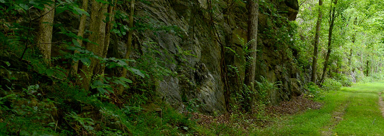
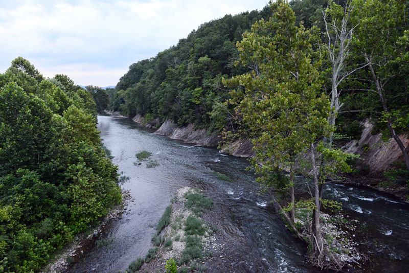
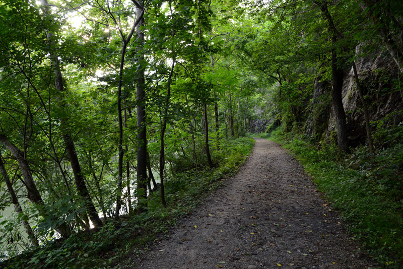
The Maury River has been cutting its channel downward over many millions of years; that process, along with blasting for the railroad and canals, exposed large sections of cliff face along the trail.
Users should beware of falling rocks along these sections and refrain from standing too close to the rocks.
Along the trail, users can see evidence of the Alleghanian Orogeny – the most recent period of mountain-building in the area. Many of the sedimentary rock layers seen along the trail were formed when this area was an ancient sea before the mountains were formed. As the Maury River has deepened its path, it (like most rivers) has undercut banks on the outside of curves and meanders. This can cause small landslides as banks collapse into the stream, and trail users might see spots of erosion at the edges of the trail as a result.
The Chessie Trail is located in the Valley and Ridge physiographic province, which contains younger rocks formed in the Cambrian Period, early in the Paleozoic Era. These rocks are much younger than those found in the Blue Ridge. The sedimentary rocks seen along the trail were folded and faulted during the mountain-building that formed the Appalachians. Rock formations seen along the trail include (starting with the Lexington end) the Edinburg Formation, Conococheague Formation, and Elbrook Formation. The deformation of these sedimentary rocks becomes apparent when examining the layering visible along the trail. Deformation can be observed on a large scale (massive rock outcrops) or a small scale (folds in the small-scale layers of sediment). Toward the Buena Vista end of the trail, users will see many caves higher up in the rock face; these were formed from the dissolution of limestone bedrock long after the area’s mountain-building event.
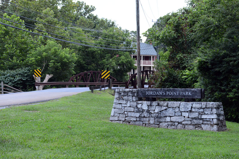
Two U.S. Geological Service gauging stations are present along the Maury, with one visible along the trail downstream of the confluence with South River. The highest flooding on record in the area was in August of 1969 when Hurricane Camille struck the area. The height of the water at that point would have covered the Chessie Trail with 10-15 feet of water. This flood halted the railroad usage in the area, and various other floods have washed out pedestrian bridges (at South River and Jordan’s Point) and done further damage to the trail.
The Maury River has relatively high-quality water, but is degraded along the trail as polluted tributaries flow into the river. Along the trail, the watershed shifts from forest-dominated to agriculture-dominated. Agricultural operations tend to contribute large amounts of nitrogen, phosphorus, fecal coliform, and sediment – some of the most serious pollutants in aquatic ecosystems – through runoff. Parking lots, interstates, buildings, and other city infrastructure also contribute high levels of pollution.
Rockbridge County is part of the Chesapeake Bay watershed, and water seen along the trail will eventually end up there. Just as polluted tributaries lower the water quality of the Maury, the Chesapeake Bay suffers from severe pollution that it receives from all of its upstream tributaries – spanning four states. Land-use practices and poor pollution management in watersheds can compound pollution downstream, whether it is in the Maury River or the Chesapeake Bay. These issues can only be mediated through a watershed-based approach that considers all connecting waterways.
The city of Lexington gets its water from the Maury River not far upstream of the start of the trail. The Maury Service Authority outflow pipe (carrying water after being treated by the Wastewater Treatment Plant) flows back into the river along the trail – a typical way to dispose of treated water. Wastewater treatment plant effluent can pollute waterways because of high levels of nitrogen, chlorine, sodium, fluoride, and other chemicals. Although aquatic ecosystems require and use nitrogen, any excess is passed downstream and becomes a problematic pollutant. An upgrade project, completed in December 2011, was necessary for the treatment plant to comply with new nutrient limits. The project will help reduce the local area’s pollution contribution to the James River and the Chesapeake Bay.
Mammals Along the Trail
Up to 43 species of resident and transient mammals may be present at some point in the ecosystem around the trail; visitors to the trail may have the opportunity to see and identify some of these mammals. Riparian corridors serve as very important habitats for a wide variety of mammals. Large mammals will use the ridgetops around the corridors or the riparian right of way to travel, while smaller mammals hide in the thick cover (one reason why extensive grooming and cutting around the trail is not used). River mammals, of course, rely on both the riparian buffer and the water itself for habitat.
Observing mammals on the trail may be very difficult because they are adapted to blend in and hide from potential predators. When looking for mammals, be sure to walk quietly and look carefully for signs of inhabitation (tracks, burrows, scat, etc.). The most common mammals observed along the trail are the same ones seen in local backyards – white-tailed deer, gray squirrels, opossum, raccoons, cotton-tailed rabbits, and groundhogs. Although voles are the most common mammal in the area, they are very rarely seen because they are small and very secretive (and often underground). The Eastern mole, also living mostly underground, may be identified by its furrows.
Right before the trail closes, bats may be seen swooping erratically overhead, some of seven or eight known species in the area. In places along the trail where the view to the river is clear, watch for aquatic mammals (river otters, beavers, and muskrats) and riparian species (raccoon and mink).
Birding on the Chessie
Birds seen along the trail may be residents or migrants. The Maury River is an important breeding area for some migrants and a “rest stop” for others. Widely varied habitats along the river — pastureland, riparian buffer, mature trees — allow for a diversity of bird species to flourish. Spring migrants come here from areas south to breed or to move yet further north, while fall migrants pass through from north to south.
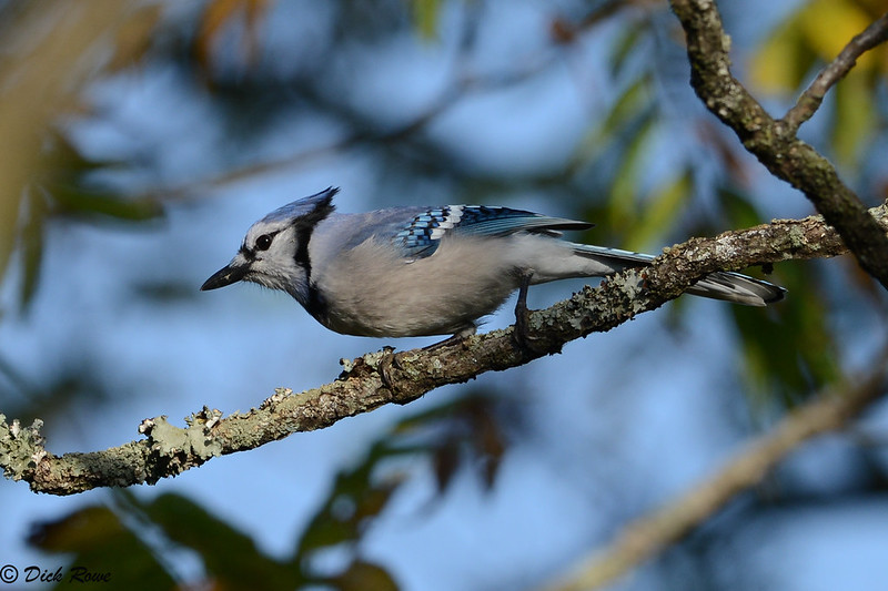
Common birds seen year-round include downy woodpeckers, crows, mourning doves, Carolina chickadees, blue jays, white-breasted nuthatches, kingfishers, and Northern cardinals.
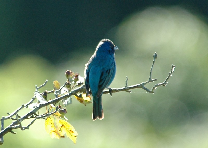
Summer residents include indigo buntings, orioles, yellow-billed cuckoos, tree swallows, barn swallows, red-eyed vireos, and eastern towhees.
Birds that pass through in spring and fall include yellow-rumped warblers, golden-crowned kinglets, brown creepers, winter wrens, and white-throated sparrows.
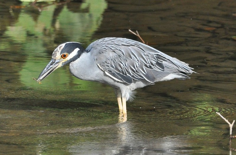
Great blue herons and other wading birds may be seen accessing the river, and a bald eagle nest has been spotted from the trail near the Buena Vista end.
Col. Rowe, a faculty member from the Department of Biology, has made available a Flickr gallery of local birds.
Plant Life
Seed plants seen along the trail include a variety of native and alien species. Common native species include bladdernut trees (Staphylea trifolia), may apple (Podophyllum peltatum), pawpaw (Asimina triloba), solomons seal (Polygonatum biflorum), spicebush (Lindera benzoin), and wild ginger (Asarum canadense). Trail users will also observe an abundance of alien invasive plants common to the area, with the worst including tree-of-heaven (Ailanthus altissima), Japanese stilt grass (Microstegium vimineum), garlic mustard (Alliaria petiolata), Japanese honeysuckle (Lonicera japonica) and other invasive honeysuckles, and autumn olive (Elaeagnus umbellate).
Alien plants are species that exist outside of their natural range; they become invasive if and when they start spreading and aggressively outcompeting native species in the area. Alien plants can evolve to become invasive very quickly, often driving out native plants that are important food sources for birds and insects. They are much more likely to take hold in areas of chronic disturbance and edge habitats – which is why they can commonly be observed around Jordan’s Point (with a history of human ecosystem disturbance) and along the edges of the trail.
In the past 200 years, the spread of alien invasives has become particularly potent due to increased worldwide commerce and travel. Only strict prevention and eradication can mediate the loss of biodiversity and ecosystem functioning caused by these species. The book Bringing Nature Home, by Douglas Tallamy, is a good reference for alien invasive species and how to support native ecosystems using your own backyard.
You can learn more about invasive species in Virginia from the Department of Conservation and Recreation.
Keep Track of Your Sightings
A checklist of bird species and plants is available to download for your personal use.
For further information
We recommend consulting quality field guides when trying to identify plants, animals, and other wildlife. The following field guides may prove useful on the trail or for further information:
- Bowers, N., R. Bowers, and K. Kaufman. 2004. Mammals of North America. Houghton Mifflin Company, New York, NY. 351 pp.
- Gleason, H.A., and A. Cronquist. 1991. Manual of Vascular Plants of the Northeastern U.S. and Adjacent Canada, 2nd ed. New York Botanical Garden, N.Y.
- Halfpenny, J.C., and J. Bruchac. 2002. Scats and Tracks of the Southeast. Globe Pequot Press, Guilford, CT. 149 pp.
- Rezendes, P. 1992. Tracking and the Art of Seeing. Camden House Publishing, Inc., Charlotte, VT. 320 pp.
- The Peterson Field Guide to Birds of North America. 2008. Houghton-Mifflin Publishing, Boston, MA.